
Geophysical Assessment and Hydrogeological Survey for Groundwater Development in Brunei Darussalam
Advanced Geophysical Exploration Using Passive Spectrum Electromagnetic Wave and Resistivity Analysis: Phase 1
![]()
Client: Confidential (Multinational Aquaculture Company)
Sector: Aquaculture Industry
Location & Timeline: Brunei Darussalam, 2023
Executive Summary
In 2023, a multinational aquaculture company operating in Brunei engaged our team to conduct an advanced assessment focused on groundwater resource evaluation. The objective was to identify a sustainable and high-quality freshwater source to support alga-culture operations, while meeting both local environmental regulations and international compliance standards. Previous assessment and drilling efforts by other contractors had failed to produce any viable water yield, resulting in significant financial losses and project delays. Recognizing the high risk of speculative drilling, the client sought a scientifically validated exploration method that could reduce uncertainty, avoid unnecessary costs, and ensure long-term water security.
We deployed a Passive Spectrum Electromagnetic Wave (PSEW) survey, combined with 1D resistivity correlation and on-site hydrogeological inspections, to precisely map subsurface aquifers. This integrated approach successfully identified multiple high-potential drilling targets, enabling the client to proceed with confidence to Phase 2 while also safeguarding environmental integrity and ensuring alignment with Brunei’s strict ESG framework.
(1).jpg)
Project Context
Groundwater is a critical operational input for aquaculture, especially for high-density alga-culture systems where water quality and quantity directly influence productivity and operational stability. In Brunei, while surface water sources are abundant, groundwater development is limited due to challenging geology, strict environmental oversight, and a small industrial footprint. For this client, securing a reliable, clean, and sustainable freshwater source was essential. The absence of accurate subsurface mapping and the history of failed borehole drilling had already highlighted the dangers of proceeding without scientific validation. Additionally, Brunei’s regulatory framework demands that industrial water extraction be supported by robust scientific evidence and environmental safeguards.
The stakes were high: without a dependable water supply, the company’s million-dollar aquaculture investment faced operational risks, potential non-compliance with local regulations, and reputational challenges in international markets.
Project Challenges
First, there was a history of failed borehole drilling in the target area. Previous attempts, based purely on conventional drilling without geophysical pre-assessment, had produced no yield despite significant costs. This created both budgetary strain and investor concern. Furthermore the lack of reliable hydrogeological mapping in the area meant that aquifer characteristics such as depth, thickness, and yield potential were largely unknown. Without such data, the risk of further failed drilling remained high.
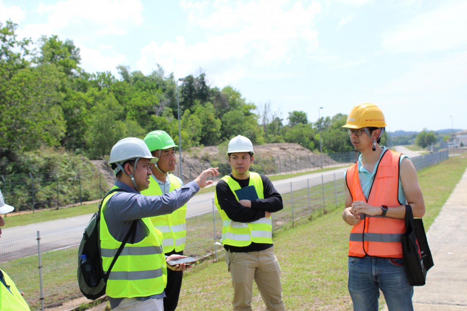
There was a shortage of local expertise in advanced aquifer detection technologies like PSEMW, which limited the ability to carry out precision surveys without bringing in external specialists. Finally, the project had to meet strict regulatory requirements under Brunei law. Compliance was not just a matter of securing permits but also demonstrating sustainable resource management and alignment with international environmental standards.
.jpg)
Our Approach
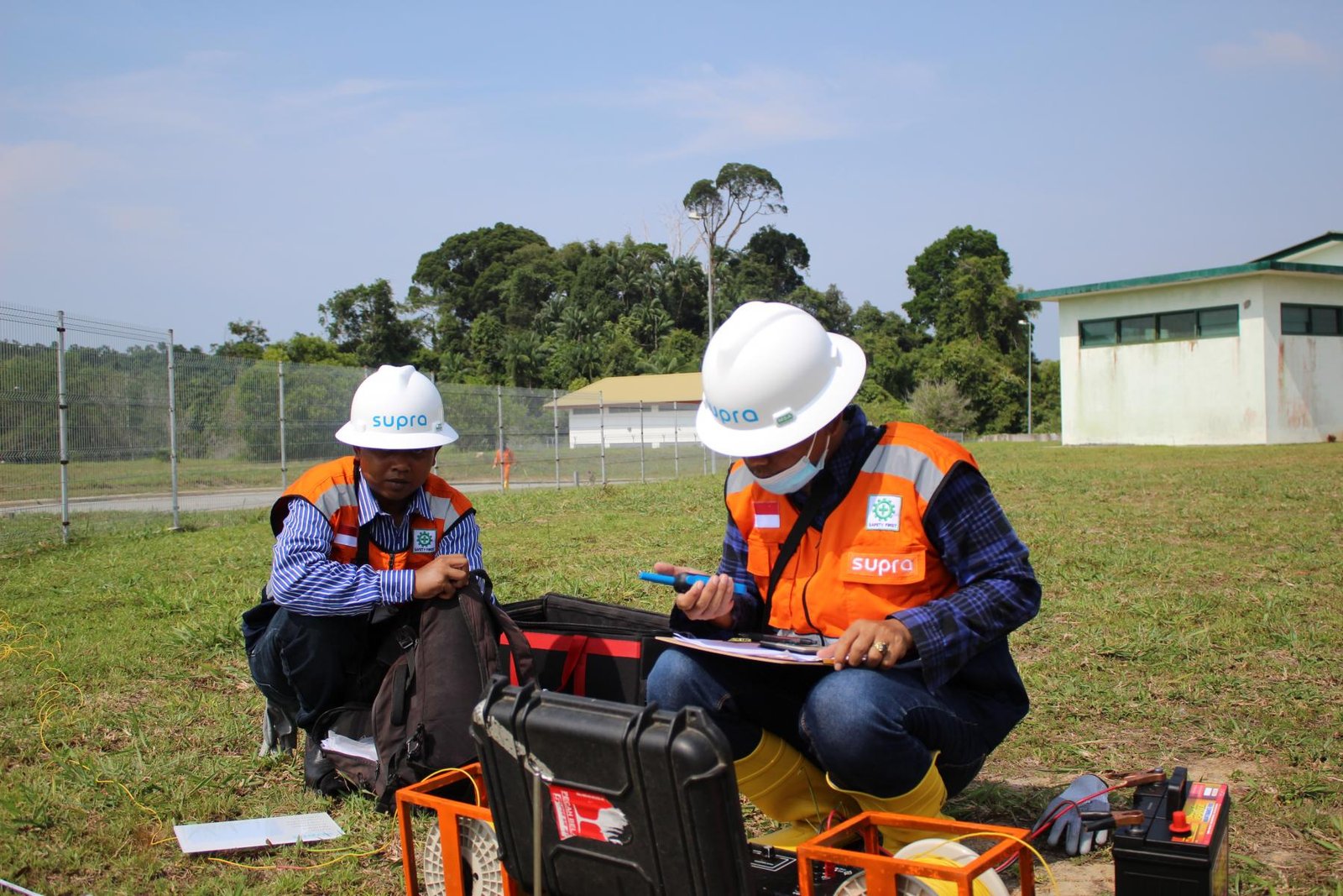
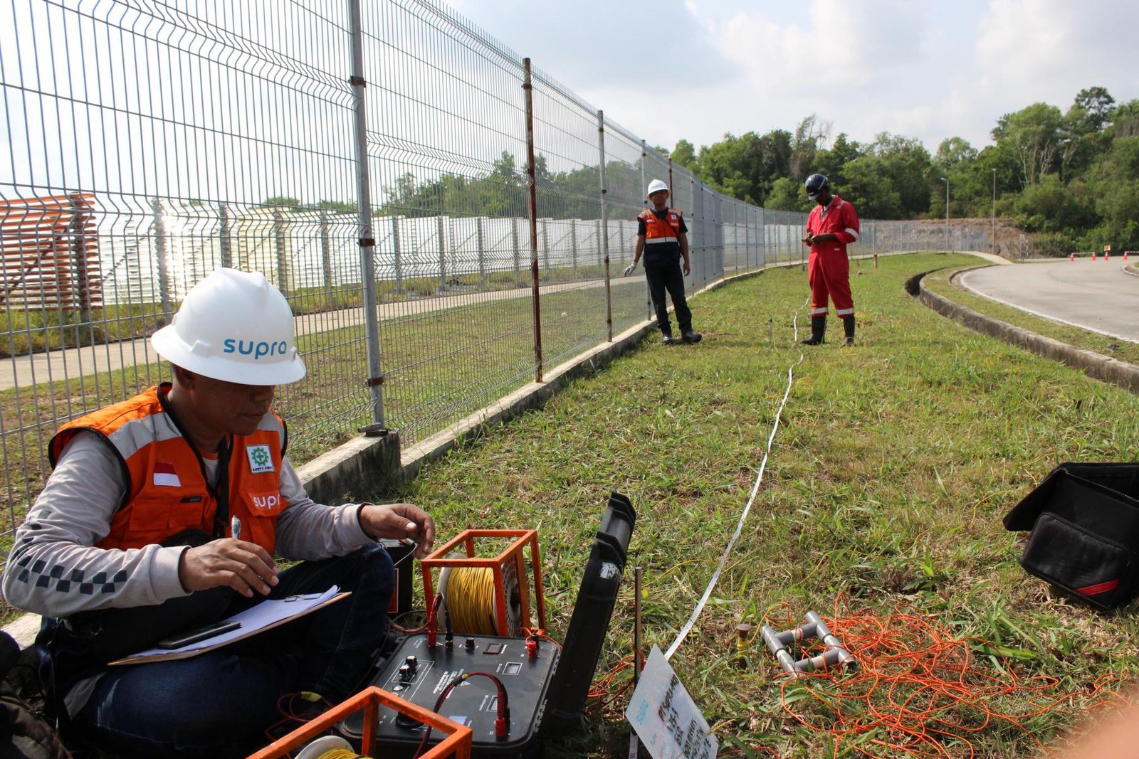
To mitigate these challenges, we designed a multi-layered exploration program combining advanced technology, field-based validation, and regulatory alignment. We began with Passive Spectrum Electromagnetic Wave (PSEW) surveys, a non-invasive technique capable of detecting aquifers with high precision and minimal environmental impact. This method allowed us to map potential groundwater zones before any physical drilling took place. The geophysical results were then cross-verified through 1D resistivity correlation, enabling us to confirm aquifer depth, thickness, and likely yield. This two-step validation significantly reduced the risk of false positives.
We complemented the geophysical work with on-site hydrogeological assessments, including soil and geological profiling, recharge potential analysis, and water quality risk evaluation. A review of regional geological literature was also conducted to assess long-term sustainability, seasonal recharge variability, and potential risks such as saltwater intrusion a known concern in coastal aquifers. Throughout the process, we integrated ESG and regulatory compliance criteria into the feasibility study, ensuring that the final recommendations could be immediately used for both internal decision-making and formal submission to Brunei’s environmental authorities. The outcome was a Go/No-Go decision framework containing high-resolution aquifer maps, prioritized drilling targets, risk profiles, and investment guidance for the next project phase.
Outcome and Impact
The project delivered a clear, evidence-based strategy for securing a sustainable water supply. Key results included:
- Identification of multiple viable aquifer targets with quantifiable yield potential.
- Prevention of further capital loss by eliminating speculative drilling.
- Alignment of the groundwater development plan with Brunei’s environmental and ESG requirements.
- Creation of a long-term water resource management framework integrated into the client’s operational planning.
Strategic Significance
This project holds broader implications for groundwater management in Southeast Asia. It revealed that aquaculture and other water-intensive industries can achieve both operational resilience and regulatory compliance through science-driven exploration methods. For the client, the benefits extend beyond immediate water security. The ability to show investors, regulators, and customers that their operations are supported by sustainable water sourcing enhances corporate reputation, supports market access in ESG-conscious markets, and reduces exposure to environmental penalties. From a regional perspective, the project sets a benchmark for precision groundwater exploration, showcasing how modern geophysics can be applied in data-scarce and highly regulated environments.
Water Resource Conditions in Brunei
Groundwater in Brunei is typically found in alluvial deposits, weathered sedimentary layers, and limited karst formations. Although annual rainfall exceeds 2,500 mm, aquifer availability is constrained by geological structure, land use, and environmental policies.
In coastal regions, saltwater intrusion poses a risk to freshwater quality, making accurate aquifer location and depth prediction critical. Brunei’s environmental regulations require that any industrial extraction be justified through comprehensive scientific studies, which aligns well with the methodology deployed in this project.
3.JPG)
Key Facts
- Advanced PSEMW and 1D resistivity surveys deployed to map aquifers.
- On-site hydrogeological assessments conducted for ground-truthing.
- Multiple high-potential groundwater sites identified for Phase 2 drilling.
- ESG and regulatory compliance integrated from project inception.
- Deliverables included high-resolution aquifer maps, depth profiles, and risk assessments.
Share:
If you face challenges in water, waste, or energy, whether it is system reliability, regulatory compliance, efficiency, or cost control, SUPRA is here to support you. When you connect with us, our experts will have a detailed discussion to understand your specific needs and determine which phase of the full-lifecycle delivery model fits your project best.